Well models (like the one below) are showing rainfall totals over 1.50 inches of rain in the valley.
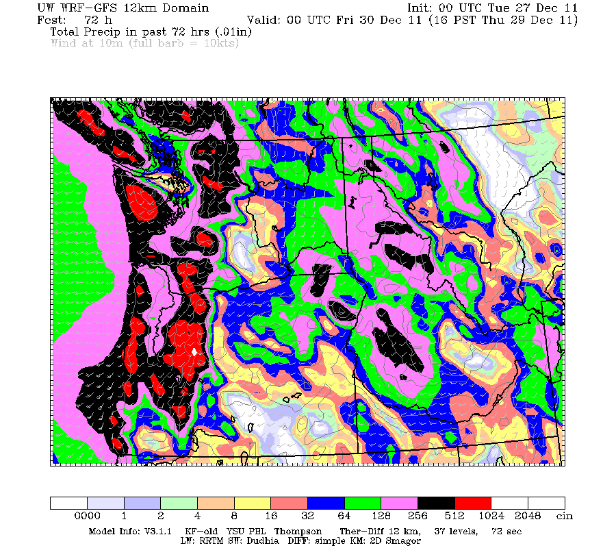
This model run (the 00z WRF-GFS) shows rain fall totals in the valley over 1.5 inches and over 5 inches in the cascades/coast range!
Now whats causing all this rain?
The reason is a strong jet stream is aimed strait at us bringing in weather systems every 1-2 days.
The image below shows the forecast for the jet stream winds.

Notice how the strong winds are aimed directly at us.
So what, strong winds, how does that give us rain?
Here is a view of the water vapor satellite imagery (this shows the water vapor or moisture in the atmosphere)

Notice how a large amount of moisture (circled in red) is aimed for us (circled in yellow)
The strong jet stream winds drive the moisture at us and give us rain.
The Forecast:
Tuesday: light rain, getting heavier in the evening
Wednesday: steady afternoon rain
Thursday: steady rain dying down in the evening.
Friday: rain again!
Now what about the winds?
Tomorrow will be quiet breezy in the evening due to pressure gradient of about 5-6 millibars between PDX and Eugene.
However on Thursday/Friday models are being inconsistent in a low pressure system so it is very uncertain on the winds.
Timberline Forecast:
Tuesday: Snow. High near 36. Windy, with a west wind between 29 and 31 mph, with gusts as high as 38 mph. Chance of precipitation is 90%. New snow accumulation of 3 to 5 inches possible.
Tuesday Night: Snow before 10pm, then rain. Snow level rising to 8400 feet. Low around 32. Windy, with a west southwest wind 30 to 33 mph increasing to between 41 and 44 mph. Winds could gust as high as 55 mph. Chance of precipitation is 100%. New snow accumulation of 1 to 3 inches possible.
Wednesday: Rain. High near 42. Windy, with a west southwest wind between 32 and 37 mph, with gusts as high as 49 mph. Chance of precipitation is 90%. New rainfall amounts between three quarters and one inch possible.
Wednesday Night: Rain before 10pm, then snow. Snow level 7500 feet lowering to 6300 feet. Low around 32. Windy, with a west southwest wind between 37 and 39 mph, with gusts as high as 50 mph. Chance of precipitation is 100%. New snow accumulation of 1 to 2 inches possible.
Thursday: Snow. High near 39. Windy. Chance of precipitation is 90%. New snow accumulation of 2 to 4 inches possible.
Thursday Night: Snow likely. Cloudy and windy, with a low around 31. Chance of precipitation is 70%. Little or no snow accumulation expected
Thanks for reading
-Michael
Nice work, Michael. Keep it up!
ReplyDelete