Now what went wrong?
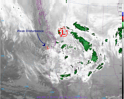
Models were showing the big surface low moving off tho the east and drying us out, now that did happen but what models did not depict is that small little disturbance (called a vorticity maximum) would approach our area and give us steady precipitation.
The image below shows the little disturbance approaching our coast.
Now moving on to this week. After a warm and dry day on Sunday a cold front will come though our area on Monday afternoon and drop snow levels down to 500-1000ft once again
The best chance for valley snow will be after about 10 pm till Tuesday morning before the air drys out.
The image below shows the sharp cold front coming through on Monday afternoon
Now the following Wednesday high pressure will build over our area giving us possibly of first 60 degree day.
The image below is the 12z GFS ensembles showing the weather roller coaster then lots of disagreement beyond Friday.
My forecast:
Thanks for reading
-Michael


No comments:
Post a Comment