Today was the warmest day so far in 2012, PDX officially hit 65 degrees with some places hitting near 70.
Now tomorrow as the day progresses clouds will roll in but the the front with the rain should hold till the overnight hours. After this front the jet stream will take aim directly at us.
The image below shows the jet stream taking aim at us on Saturday
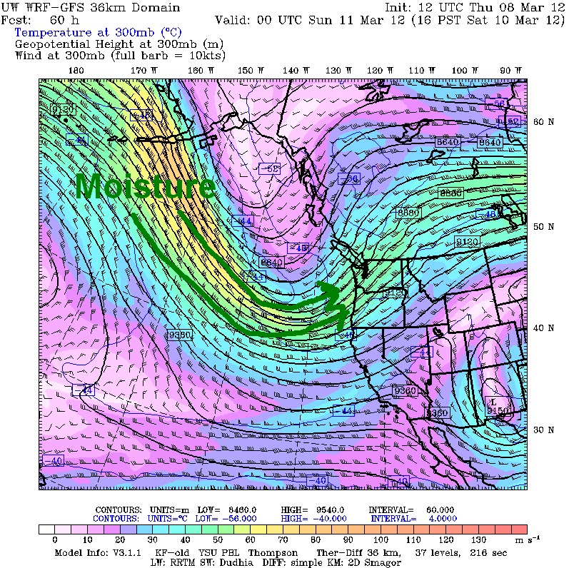
As you can see the Jet stream delivers lots of moisture with it which gives us rain.
Now the catch is this jet stream is not moving anywhere, here it is again next Thursday

So just how much rain will we get?
Well the 12z WRF-GFS below gives us 1.5 inches of rain in 72 hours by Tuesday morning

Also on Monday a deep low pressure system will pas to our northwest giving the coast winds sustained near 60mph, now depending on how far west this low pressure will go will depend if the valley will get good wind.
The image below is the 00z WRF-GFS showing the low pressure producing winds of 50 knots of the coast.

My forecast:

Thanks for reading
-Michael
No comments:
Post a Comment