In the video below by Steve Pierce it shows winds at crown point on January 7th,2010 reaching over 100 mph!
Moving on, Models are now showing a pattern change from this high pressure to a more zonal flow (weather systems coming every few days).
in the image below of the 00z GFS-WRF shows our current pattern

A big hing pressure is sitting over us.
now here is the jet stream on next Thursday
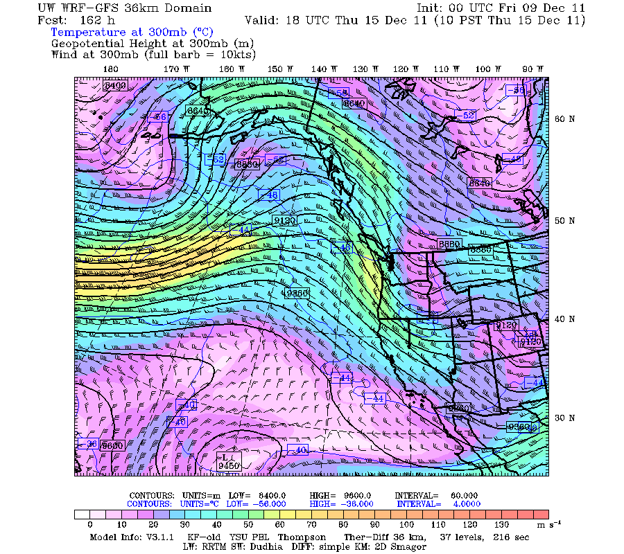
The high pressure is gone and the strong westerly jet is aiming at us.
bottom line is that the weather will change to more wet and cool.
For skiers and snowboarders:
Timberline forecast:
Friday: Sunny, with a high near 47. South southeast wind around 14 mph, with gusts as high as 21 mph.
Friday Night: Mostly clear, with a low around 31. South southwest wind around 9 mph.
Saturday: Partly sunny, with a high near 37. West southwest wind around 11 mph.
Saturday Night: A 20 percent chance of snow. Mostly cloudy, with a low around 20. West wind around 15 mph, with gusts as high as 23 mph.
Sunday: A 30 percent chance of snow showers, mainly after 10am. Mostly cloudy, with a high near 26. New snow accumulation of less than a half inch possible.
Sunday Night: Mostly cloudy, with a low around 20.
Monday: Partly sunny, with a high near 30.
Monday Night: Mostly cloudy, with a low around 22.
Tuesday: A chance of snow. Mostly cloudy, with a high near 30.
Thanks for reading
-Michael
No comments:
Post a Comment