Just for fun this is the forecast for MT Rainier:
Wednesday: Snow. High near 9. Breezy. Chance of precipitation is 100%. New snow accumulation of 36 to 42 inches possible.
Wednesday Night: Snow. Low around -2. Breezy. Chance of precipitation is 90%. New snow accumulation of 30 to 36 inches possible.
Now that's a lot of snow!
Update: I forgot to add that Friday night and Saturday morning there is a chance of a rain snow mix down in the valley.
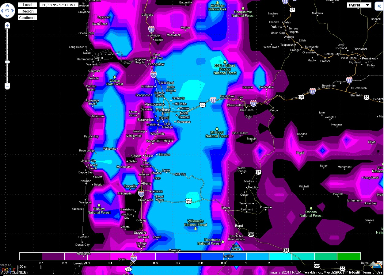
this picture below shows snow only in the mountains on Monday morning but one thing it does not take into consideration is east winds blowing from the gorge. why does that matter? it matters because east winds blow cold air from the gorge in winter time and because of that there could be a transition from snow to rain as the warm front passes. When the east to west pressure gradient will go away during the front the east wind will stop and snow will transition into rain. Keep in mind this is one week away and could change!

Update: I forgot to add that Friday night and Saturday morning there is a chance of a rain snow mix down in the valley.
this picture below shows snow only in the mountains on Monday morning but one thing it does not take into consideration is east winds blowing from the gorge. why does that matter? it matters because east winds blow cold air from the gorge in winter time and because of that there could be a transition from snow to rain as the warm front passes. When the east to west pressure gradient will go away during the front the east wind will stop and snow will transition into rain. Keep in mind this is one week away and could change!

No comments:
Post a Comment