Wednesday, December 28, 2011

Rain Totals and Low Snow Levels.

The past 24 hours have been very wet. just look at the 24 hour rainfall totals.
The image below shows the 24 hour rainfall totals ending at 4:30pm in the east metro area.
6.56 inches at Log Creek!
Here are the 24 hour rainfall totals ending at 4:30pm in the west metro area. 
5.24 inches of  rain at Lees Camp!
All this precipitation has been rain in the mountains below 7.000 feet which is really bad for ski resorts
just look at this photo of a big puddle at Hoodo Ski Resort

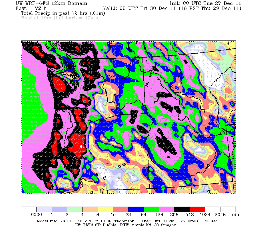
 however on Friday afternoon a cold front will come through and lower the snow lever below pass levels and dump close to a foot of new snow in the mountains.
That same cold front will drop snow levels down to about 1,500 feet on Friday afternoon giving us in the valley, hail or ice pellets in heavy showers.
Some other good news is that New Years is looking dry due to a ridge of high pressure building over our area.
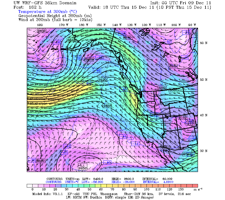
The image below shows the ridge of high pressure(indicated in blue) over us on New Years day

Forecast:
Thursday: Dry in the morning, steady afternoon rain.high temp:52
Friday: Morning rain, afternoon showers mixed with hail or ice pellets. high temp 53 lowering to 42
Saturday: Morning showers then dry. high temp: 48
 Timberline forecast:
Thursday: Snow. High near 37. Breezy, with a west wind between 25 and 29 mph, with gusts as high as 34 mph. Chance of precipitation is 90%. New snow accumulation of 3 to 7 inches possible. 

Thursday Night: Rain and snow. Snow level rising to 7100 feet. Temperature rising to around 35 by 1am. Windy, with a west southwest wind between 23 and 32 mph, with gusts as high as 39 mph. Chance of precipitation is 100%. New snow accumulation of 7 to 11 inches possible. 

Friday: Rain and snow showers, becoming all snow after 10am. High near 36. Windy, with a west wind between 28 and 32 mph, with gusts as high as 39 mph. Chance of precipitation is 100%. New snow accumulation of 5 to 9 inches possible. 

Friday Night: Snow showers. Low around 26. Windy, with a west wind between 28 and 32 mph, with gusts as high as 38 mph. Chance of precipitation is 80%. New snow accumulation of 2 to 4 inches possible. 

Saturday: A 50 percent chance of snow showers. Mostly cloudy, with a high near 33. Little or no snow accumulation expected. 

Saturday Night: A 20 percent chance of snow showers. Mostly cloudy, with a low around 28. 
Thanks for reading 
-Michael

Monday, December 26, 2011

Wet Week and Possibility for Wind.

The pattern has now officially changed to wet. This week is going to be very wet. How wet?
Well models (like the one below) are showing rainfall totals over 1.50 inches of rain in the valley.
This model run (the 00z WRF-GFS) shows rain fall totals in the valley over 1.5 inches and over 5 inches in the cascades/coast range!
Now whats causing all this rain?
The reason is a strong jet stream is aimed strait at us bringing in weather systems every 1-2 days.
The image below shows the forecast for the jet stream winds.
Notice how the strong winds are aimed directly at us.
So what, strong winds, how does that give us rain?
Here is a view of the water vapor satellite imagery (this shows the water vapor or moisture in the atmosphere) 
Notice how a large amount of moisture (circled in red) is aimed for us (circled in yellow)
The strong jet stream winds drive the moisture at us and give us rain.
The Forecast:
Tuesday: light rain, getting heavier in the evening
Wednesday: steady afternoon rain
Thursday: steady rain dying down in the evening.
Friday: rain again!
Now what about the winds?
Tomorrow will be quiet breezy in the evening due to pressure gradient of about 5-6 millibars between PDX and Eugene.
However on Thursday/Friday models are being inconsistent in a low pressure system so it is very uncertain on the winds.
Timberline Forecast:
Tuesday: Snow. High near 36. Windy, with a west wind between 29 and 31 mph, with gusts as high as 38 mph. Chance of precipitation is 90%. New snow accumulation of 3 to 5 inches possible. 

Tuesday Night: Snow before 10pm, then rain. Snow level rising to 8400 feet. Low around 32. Windy, with a west southwest wind 30 to 33 mph increasing to between 41 and 44 mph. Winds could gust as high as 55 mph. Chance of precipitation is 100%. New snow accumulation of 1 to 3 inches possible. 

Wednesday: Rain. High near 42. Windy, with a west southwest wind between 32 and 37 mph, with gusts as high as 49 mph. Chance of precipitation is 90%. New rainfall amounts between three quarters and one inch possible. 

Wednesday Night: Rain before 10pm, then snow. Snow level 7500 feet lowering to 6300 feet. Low around 32. Windy, with a west southwest wind between 37 and 39 mph, with gusts as high as 50 mph. Chance of precipitation is 100%. New snow accumulation of 1 to 2 inches possible. 

Thursday: Snow. High near 39. Windy. Chance of precipitation is 90%. New snow accumulation of 2 to 4 inches possible. 

Thursday Night: Snow likely. Cloudy and windy, with a low around 31. Chance of precipitation is 70%. Little or no snow accumulation expected
Thanks for reading
-Michael


Wednesday, December 21, 2011

Christmas Gift of a Pattern Change.

Finally a pattern change and i'm not advertising this like Obama does. 
So far this December has had a big ridge of high pressure sitting on top of us giving us dry and foggy weather
the image below shows the jet stream winds and I have indicated the ridge of high pressure in red
How does this give us dry weather? This gives us dry weather by making all the moisture ride the jet stream over and around the high. Now this week starting Christmas day  that high pressure will move east and allow the jet stream to aim at us
The image above shows the forecast for the jet stream winds on Tuesday, notice how the strong winds (yellow color) are aimed strait at us.  
Christmas Forecast:
Christmas eve:  A weak warm front will move to the north of us  giving us a few showers but we should stay mostly dry.
Christmas day: A cold front following the warm front will come through giving us rain followed by showers.
Following Christmas the week looks pretty wet.
I probably wont be posting till after Christmas so....
Timberline Forecast:
Thursday: Mostly sunny, with a high near 35. South southeast wind between 15 and 17 mph, with gusts as high as 25 mph. 

Thursday Night: Mostly cloudy, with a low around 23. South southwest wind between 14 and 17 mph, with gusts as high as 23 mph. 

Friday: A 50 percent chance of snow, mainly before 4pm. Mostly cloudy, with a high near 34. Breezy, with a west wind between 21 and 23 mph, with gusts as high as 32 mph. New snow accumulation of less than a half inch possible. 

Friday Night: A 20 percent chance of snow before 10pm. Mostly cloudy, with a low around 25. West wind around 13 mph. 

Saturday: Mostly sunny, with a high near 35. 

Saturday Night: Mostly cloudy, with a low around 27. 

Christmas Day: A chance of snow. Mostly cloudy, with a high near 33. 

Sunday Night: A chance of snow. Mostly cloudy, with a low around 27. 

Monday: A chance of snow. Mostly cloudy, with a high near 34. 

Monday Night: A chance of snow. Mostly cloudy, with a low around 26. 

Thanks for reading 
-Michael

Saturday, December 17, 2011

Strong Inversion and a Possible Record Dry December.

This month has been very dry so far.
Here are the top 10 driest Decembers on record in Portland.
 Year / December Precip
2011 / 0.06 (through 12/16)
1876 / 0.88 
1976 / 1.38 
1944 / 1.90 
1985 / 2.19 
1988 / 2.37 
1990 / 2.40 
1978 / 2.51 
1914 / 2.56 
1984 / 2.56 
and this pattern just does not want to break down, the image below shows a big ridge of high pressure over the area all the way to next Saturday.  
As for today there is a really strong inversion overhead here is an image of today's SLE(Salem) sounding
It's 14.2degrees C (58F) at 900mb (3,200ft) while its near freezing in the valley.
Also up at Timberline Lodge its 52 degrees as of 12:00PM
 bottom line is that there will be a few days with light rain this week but it will stay mostly dry.
For skiers and snowboarders:
Timberline Forecast:
 Sunday: A 50 percent chance of snow showers, mainly before 4pm. Mostly cloudy, with a high near 34. West northwest wind between 8 and 13 mph. Little or no snow accumulation expected. 

Sunday Night: A 20 percent chance of snow showers, mainly before 10pm. Mostly cloudy, with a low around 26. Northwest wind 7 to 9 mph becoming east northeast. 

Monday: Mostly sunny, with a high near 34. East northeast wind around 6 mph becoming northwest. 

Monday Night: Mostly cloudy, with a low around 25. 

Tuesday: Mostly cloudy, with a high near 36. 

Tuesday Night: A chance of snow. Mostly cloudy, with a low around 25. 

Wednesday: A chance of snow showers. Mostly cloudy, with a high near 28. 

Wednesday Night: A slight chance of snow showers. Mostly cloudy, with a low around 22. 

Thursday: Partly sunny, with a high near 32. 

Thanks for reading
-Michael

Tuesday, December 13, 2011

Very Dry December and Lack of Snow.

This December has been very dry so far, PDX has only received 0.01 inches of rain so far this month compare that to the December average of 5.49 inches. But it's not only us, the eastern half of the county has had very little snow as well.
The image below shows the total snow on the ground on December 12 (yesterday)
But look at the same time last year.
A really big difference!
Now whats the reason for this? The reason is there is two big upper level ridges (circled in red) are allowing the cold and moist air(yellow arrow) to ride over the U.S and only allowing small troughs (which carry cold air) to drop down.     
Tomorrow: In the previous post I mentioned a chance of snow, well now its pretty much gone as tha low pressure will go to far north a will be very weak so the only chance of frozen precipitation will be in the gorge.
The image below is the 12z GFS-WRF showing the weak low to far north and the lack of cold air.
Later this weak: Yet again the high pressure will build back over us giving us yet more dry weather and no snow for the cascades.
The image below shows the high pressure over us on Friday.

For skiers and snowboarders:
  Timberline forecast:
 Wednesday: A 30 percent chance of snow after 4pm. Mostly cloudy, with a high near 36. West southwest wind between 8 and 14 mph, with gusts as high as 21 mph. Little or no snow accumulation expected. 

Wednesday Night: Snow likely, mainly after 10pm. Cloudy, with a low around 23. Southwest wind between 18 and 20 mph, with gusts as high as 30 mph. Chance of precipitation is 70%. New snow accumulation of 1 to 3 inches possible. 

Thursday: Snow showers likely, mainly before 10am. Cloudy, with a high near 31. West wind around 18 mph, with gusts as high as 28 mph. Chance of precipitation is 70%. New snow accumulation of 1 to 2 inches possible. 

Thursday Night: A 30 percent chance of snow showers, mainly before 10pm. Mostly cloudy, with a low around 21. West wind between 6 and 9 mph becoming calm. Little or no snow accumulation expected. 

Friday: A 10 percent chance of snow showers before 10am. Partly sunny, with a high near 36. 

Friday Night: Mostly cloudy, with a low around 22. 

Saturday: Mostly cloudy, with a high near 35. 

Thanks for reading 
-Michael

Saturday, December 10, 2011

Icy roads and Possibility of Snow.

In my previous post I was talking about the wind in the gorge...well the numbers are in. At crown point (vista house) the official peak wind gust was 78 mph but a member of the Oregon AMS recorded a Gust of 87.1 mph!
Moving on: This morning some locations had very heavy frost due to freezing fog like in the picture below which was taken in the Hillboro area.
Yes, that is frost not snow!
later on this evening a week front came through and brought freezing drizzle to many locations and temperatures will remain near freezing overnight so watch out for ice in the morning.
Sunday, Monday and Tuesday are going to be dry but on Wednesday night and Thursday morning a low pressure system will slide down the coast to the west of us. Now why is this interesting? this interesting because it is in a similar position that usually gives us snow. now the only problem is that models are showing that the east winds from the low will be washed out by south winds fast enough for it not to snow.
However model resolution is not high enough to take account of the gorge.
Here is the 00z GFS showing the low to the southwest of us.
Here is a check list for snow for this setup
Cold east winds - Uncertain  
850 mb temps at -8c or lower- No
Moisture- Yes 
The low is centered to the southwest of us- Yes
Bottom line is that this is very uncertain and depends on if the easterly flow will be washed out to soon. but if it will snow totals would be around 2 -3 inches.
Beyond that is appears that the high pressure ridge along with a cut-off  is back giving us more dry weather.
Here is the 00z GFS-WRF showing the setup that will give us more dry weather.

For skiers and snowboarders:
Timberline forecast:
Sunday: A slight chance of drizzle and flurries before 10am, then a chance of snow showers. Mostly cloudy, with a high near 23. Northwest wind between 6 and 10 mph. Chance of precipitation is 30%. Little or no snow accumulation expected. 

Sunday Night: A 20 percent chance of snow showers before 10pm. Mostly cloudy, with a low around 19. East northeast wind between 5 and 8 mph. 

Monday: Mostly sunny, with a high near 28. East wind around 10 mph. 

Monday Night: Mostly cloudy, with a low around 22. East wind around 7 mph becoming southwest. 

Tuesday: A 20 percent chance of snow after 10am. Mostly cloudy, with a high near 31. 

Tuesday Night: A 30 percent chance of snow. Mostly cloudy, with a low around 24. Little or no snow accumulation expected. 

Wednesday: A chance of snow. Mostly cloudy, with a high near 30. 
Thanks for reading and feel free to comment
-Michael

Thursday, December 8, 2011

East Wind and a Pattern Change.

If you really like strong wind go up to Crown Point tomorrow. Why is there going to be strong winds there? there is going to be strong wind there because of a pressure gradient of -8mb across the cascades and the gorge acts as a funnel channeling the wind. currently as of 10:00 pm the gradient is -6.0mb and wind has gusted up to 52mph. Tomorrow morning and afternoon wind will be gusting 75-80 mph!
In the video below  by Steve Pierce it shows winds at crown point on January 7th,2010 reaching over 100 mph!   

Moving on, Models are now showing a pattern change from this high pressure to a more zonal flow (weather systems coming every few days).
in the image below of the 00z GFS-WRF shows our current pattern
A big hing pressure is sitting over us.
now here is the jet stream on next Thursday 
The high pressure is gone and the strong westerly jet is aiming at us.
bottom line is that the weather will change to more wet and cool.
For skiers and snowboarders:
Timberline forecast:
Friday: Sunny, with a high near 47. South southeast wind around 14 mph, with gusts as high as 21 mph. 

Friday Night: Mostly clear, with a low around 31. South southwest wind around 9 mph. 

Saturday: Partly sunny, with a high near 37. West southwest wind around 11 mph. 

Saturday Night: A 20 percent chance of snow. Mostly cloudy, with a low around 20. West wind around 15 mph, with gusts as high as 23 mph. 

Sunday: A 30 percent chance of snow showers, mainly after 10am. Mostly cloudy, with a high near 26. New snow accumulation of less than a half inch possible. 

Sunday Night: Mostly cloudy, with a low around 20. 

Monday: Partly sunny, with a high near 30. 

Monday Night: Mostly cloudy, with a low around 22. 

Tuesday: A chance of snow. Mostly cloudy, with a high near 30. 
Thanks for reading
-Michael


Tuesday, December 6, 2011

Big Inversion.

Why has it been so cold lately? The reason is there is a big yet thin inversion over us causing all this fog and bad air quality.
A good example of this inversion is, today at noon the temperature at Portland airport was 35 while at the same time Timberline lodge was 48. The high at PDX was only 36 today and in Battle Ground here I got a high 33!
Here in the image below are the KPTV tower temps.
As you can see the temp on the bottom sensor is almost 20 degrees cooler then the one on top which is completely opposite of how it normally is.
This inversion has also given us a lot of dense fog and at night freezing fog so be careful driving in the mornings.
The image below is a great shot of the inversion today taken by Tyler Mode.
This was taken from Silver Star Mt. and below you can see the Vancouver metro area socked in with fog.
As for the forecast Saturday looks to have a small chance of some rain but the rest of the week will be dry.
For skiers and snowboarders:
Timberline forecast:
Wednesday: Mostly sunny, with a temperature rising to near 34 by noon, then falling to around 26 during the remainder of the day. Northwest wind between 10 and 13 mph. 

Wednesday Night: Partly cloudy, with a low around 23. North wind 8 to 13 mph becoming east. 

Thursday: Mostly sunny, with a high near 38. East wind around 10 mph. 

Thursday Night: Mostly clear, with a low around 25. East southeast wind around 8 mph. 

Friday: Mostly sunny, with a high near 35. 

Friday Night: Mostly cloudy, with a low around 21. 

Saturday: Partly sunny, with a high near 30. 

Saturday Night: A slight chance of snow showers. Mostly cloudy, with a low around 19. 

Sunday: A chance of snow showers. Mostly cloudy, with a high near 27. 

Sunday Night: A slight chance of snow showers. Mostly cloudy, with a low around 19. 

Thanks for reading 
-Michael  

Friday, December 2, 2011

Arctic Blast Not Looking so Good.

In my previous post I said how models were hinting at cold arctic air coming down into our area. Well now models have done a complete flip flop sending the arctic air into eastern Montana.
Here is an example of how models flipped 
Here is the 12z GFS-WRF from Wednesday 
  This shows arctic air right over the Portland area 
Now here is yesterdays 00z GFS-WRF 
It shows the arctic air far to our northeast 
Now here is today's  00z GFS-WRF  
arctic air is a little closer but still not close enough
What is the reason for it not being close enough? The reason for this is a strong westerly jet is causing a small upper level low north of Hawaii to go farther west and not allowing the upper level high to move east.
bottom line is an arctic blast is not looking likely but just cooler temps and dry conditions will occur.
here is text output of the 00z GFS
Very dry all the way till the 15th 
For skiers and snowboarders:
Timberline forecast:
 Saturday: Sunny, with a high near 35. East northeast wind between 7 and 9 mph. 

Saturday Night: Clear, with a low around 21. North northwest wind between 6 and 8 mph. 

Sunday: Sunny, with a high near 29. Northeast wind around 11 mph. 

Sunday Night: Mostly clear, with a low around 21. Calm wind.

Monday: Sunny, with a high near 34. 

Monday Night: Mostly clear, with a low around 26. 

Tuesday: Sunny, with a high near 37. 

Tuesday Night: Mostly clear, with a low around 26. 

Wednesday: Sunny, with a high near 33.

Wednesday, November 30, 2011

Arctic Air Next Week?

Note: this can change
Next week: models today have started hinting at really cold air coming in next week.
The reason for this cold is the upper level high over us currently is going to move west. But how far it moves west will make it depend on how cold it will get.
The image below shows today's mornings 12z GFS-WRF 500mb temps.
Notice how the cold air (purple color) is right over Washington and Oregon
however 
Tonight's 00z GFS-WRF 
Notice how the purple has moved more east on this run 
So bottom line is it will depend on how far this high pressure moves west if it moves not to far then no arctic air, if it moves farther away then we get arctic air.
Also here is a image of the 12z euro ensembles showing the 850mb temps

   Most of them are scattered  but there is a large group that brings the temps down to -10c

For skiers and snow boarders:
Timberline forecast:
Thursday: Sunny, with a high near 34. East wind between 11 and 15 mph, with gusts as high as 18 mph. 

Thursday Night: Mostly clear, with a low around 20. Light wind becoming west northwest between 12 and 15 mph. Winds could gust as high as 20 mph.

Friday: Sunny, with a high near 32. North wind between 7 and 16 mph, with gusts as high as 20 mph. 

Friday Night: Mostly clear, with a low around 24. East northeast wind between 7 and 9 mph. 

Saturday: Sunny, with a high near 34. 

Saturday Night: Mostly clear, with a low around 33. 

Sunday: Sunny, with a high near 35. 

Thanks for reading 
-Michael 

Monday, November 28, 2011

Dry Week Ahead.

Models are now very consistent in showing a large upper level high developing on Thursday just to the west of us and giving us dry weather starting Wednesday afternoon.
On Tuesday overnite into Wednesday a week clipper system will move through the area bringing, light rain fall totals and a few inches of snow down to the mountain passes.
After this system passes a large upper level high develops just to the west of us keeping us dry and models are showing it hanging on until around next Thursday 
the image below shows the 12z GFS-WRF 500mb chart showing the high pressure on Thursday
  watch as it continues on to Saturday 
Along with it this will also bring very high snow levels up to around 7,000-8,000ft
The image below has the 18z GFS showing 850mb (5,000ft) temps
Temps are over 8c in the cascades 
during this time a low level high develops to the east of us giving us light east winds, these winds will cause an inversion (warmer above then below) so daytime highs will only be in the 40s. While the lows in outlying areas will be down into the low 20s

for skiers and snowboarders:
Timberline forecast:
Tuesday: Snow showers likely after 4pm. Partly sunny, with a high near 41. West northwest wind between 5 and 8 mph. Chance of precipitation is 60%. New snow accumulation of less than a half inch possible. 

Tuesday Night: Snow showers, mainly before 4am. Low around 23. Breezy, with a west wind between 18 and 23 mph. Chance of precipitation is 80%. New snow accumulation of 3 to 5 inches possible. 

Wednesday: A 30 percent chance of snow showers, mainly before 10am. Partly sunny, with a high near 32. Northwest wind between 10 and 16 mph. Little or no snow accumulation expected. 

Wednesday Night: Partly cloudy, with a low around 23. East northeast wind between 10 and 17 mph, with gusts as high as 21 mph. 

Thursday: Sunny, with a high near 37. 

Thursday Night: Mostly clear, with a low around 25. 

Friday: Mostly sunny, with a high near 37. 
Thanks for reading
-Michael

Friday, November 25, 2011

Uneventful Dry Week Ahead.

Compared to last week these next two weeks are going to be very calm and dry.
Here is text output of the 18z GFS model from Brian Schmits program.
Note: the high temps are not accurate.
After Sundays cold front comes through Monday and Tuesday look to be dry however a very small system could pass through the area on Wednesday but it will give us very small rainfall totals. After the system on Wednesday models are showing an area of high pressure building up over the area giving us dry weather the rest of the week to put up your Christmas lights.  
The image below shows the 18z GFS model showing high pressure building over the area on Thursday
For skiers ans snowboarders:
Timberline forecast:
   Saturday: A 20 percent chance of rain before 10am. Mostly cloudy, with a high near 39. Southwest wind between 14 and 17 mph, with gusts as high as 22 mph. 

Saturday Night: A 30 percent chance of rain, mainly after 4am. Mostly cloudy, with a low around 30. Breezy, with a southwest wind between 20 and 26 mph, with gusts as high as 33 mph. 

Sunday: Rain before 4pm, then rain, possibly mixed with snow. High near 34. Windy, with a west southwest wind between 30 and 36 mph, with gusts as high as 45 mph. Chance of precipitation is 90%. New snow accumulation of around an inch possible. 

Sunday Night: Snow likely, mainly before 4am. Cloudy, with a low around 26. Breezy, with a west wind between 14 and 22 mph, with gusts as high as 28 mph. Chance of precipitation is 70%. New snow accumulation of 2 to 4 inches possible. 

Monday: A 30 percent chance of snow showers, mainly before 10am. Mostly cloudy, with a high near 33. Little or no snow accumulation expected. 

Thanks for reading!
-Michael