
Saturday the 25th
Now earlier this week models were supporting temperatures cold enough for snow down to sea level. however over the past few days models have warmed that cold air just slightly but enough to not give us snow.
The image below is the WRF-GFS cross section forecast
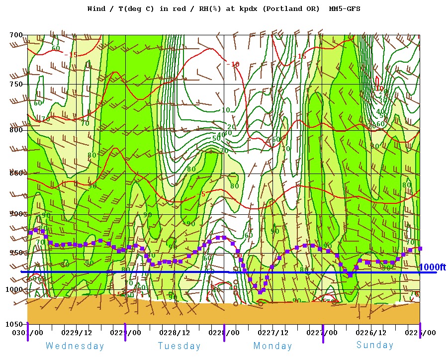
The dotted purple line is 32 degrees or freezing the solid blue line represents 1000ft, notice how the dotted line barely goes below the 1000ft mark.
Also when the coldest air arrives in Monday the air dries out and we have no precip.
So what will we see?
- Snow levels 1000-1500ft
- Possible rain/snow mix in showers Sunday night
- NO ACCUMULATING SNOW in the valleys.
- Scattered cold rain showers
- Cold but dry Monday morning
My forecast:

I have seen this set up before where ... Please in the lowest places of the coast and valley do get snow
ReplyDelete